
An Introduction to Photogrammetry
At Carleton Immersive Media Studio (CIMS), the process of photogrammetry is used frequently for the documentation of heritage buildings and artifacts. We have been able to use photogrammetry to document built heritage on multiple scales, including The Parliament Hill National Historic Site of Canada, Buddhist Temples in Bagan, Myanmar, artwork in the Canadian High Arctic Research Station in Cambridge Bay, Nunavut, and sculptures in the Senate Chambers of Canadian Parliament.
But what is photogrammetry, and why is it used?
Photogrammetry — or photographic measurement — is credited with being invented by two people — Aime Laussedat and Albrecht Meydenbauer. In 1851, Aime Laussedat created a method to generate topographic maps from aerial photography. Albrecht Meydenbauer further refined the techniques to apply to the measurement of buildings when a near-death experience made him look for a safer way to document structures. When surveying the Cathedral of Wetzlar in 1858, he almost fell to his death from the side-aisle of the cathedral. The incident motivated him to find a better method of measuring buildings using indirect measurements in photographs. Photogrammetry, as a method to document the surfaces, of buildings was born.
Photogrammetry allows us to create accurate and highly detailed measurements of existing objects, buildings and topography. Today it is used in architecture, engineering, manufacturing, police investigation, archeology, meteorology and gaming/animation. It is even used in Hollywood with photogrammetry used in the movie Fight Club for geometry to simulate the apartment explosion scene and in the video game Star Wars Battlefront to generate realistic vegetation from existing forests.
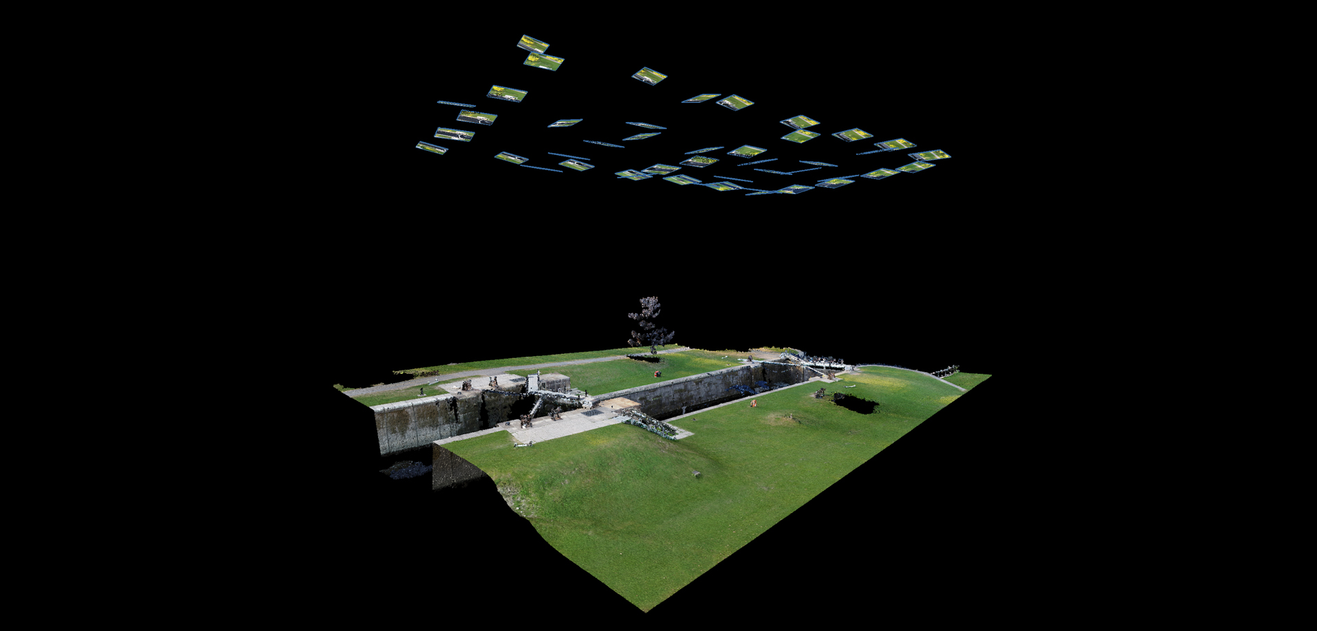
Originally, photogrammetry was captured using specialty ‘metric’ cameras that allowed for the calculation of measurements using few images. Modern photogrammetry allows for the use of a standard consumer-grade digital single-lens reflex camera (DSLR camera). Hundreds — and sometimes thousands — of photographs are taken of a surface and then aligned using common points in a specialized—but accessible—software.
The most challenging part of photogrammetry is the employed photography technique; if the images are not taken properly, the software will not be able to reconstruct the geometry. This involves manually controlling your camera’s settings and taking photos in optimal locations. CIMS closely follow the guidelines for good practice of photogrammetry prescribed by English Heritage and CIPA. One of the most important aspects of photogrammetric acquisition is ensuring each subsequent image has enough overlap. It is recommended that there is about 60-80% commonality between photos to ensure there is enough area for the software to recognize similarities and match the images.
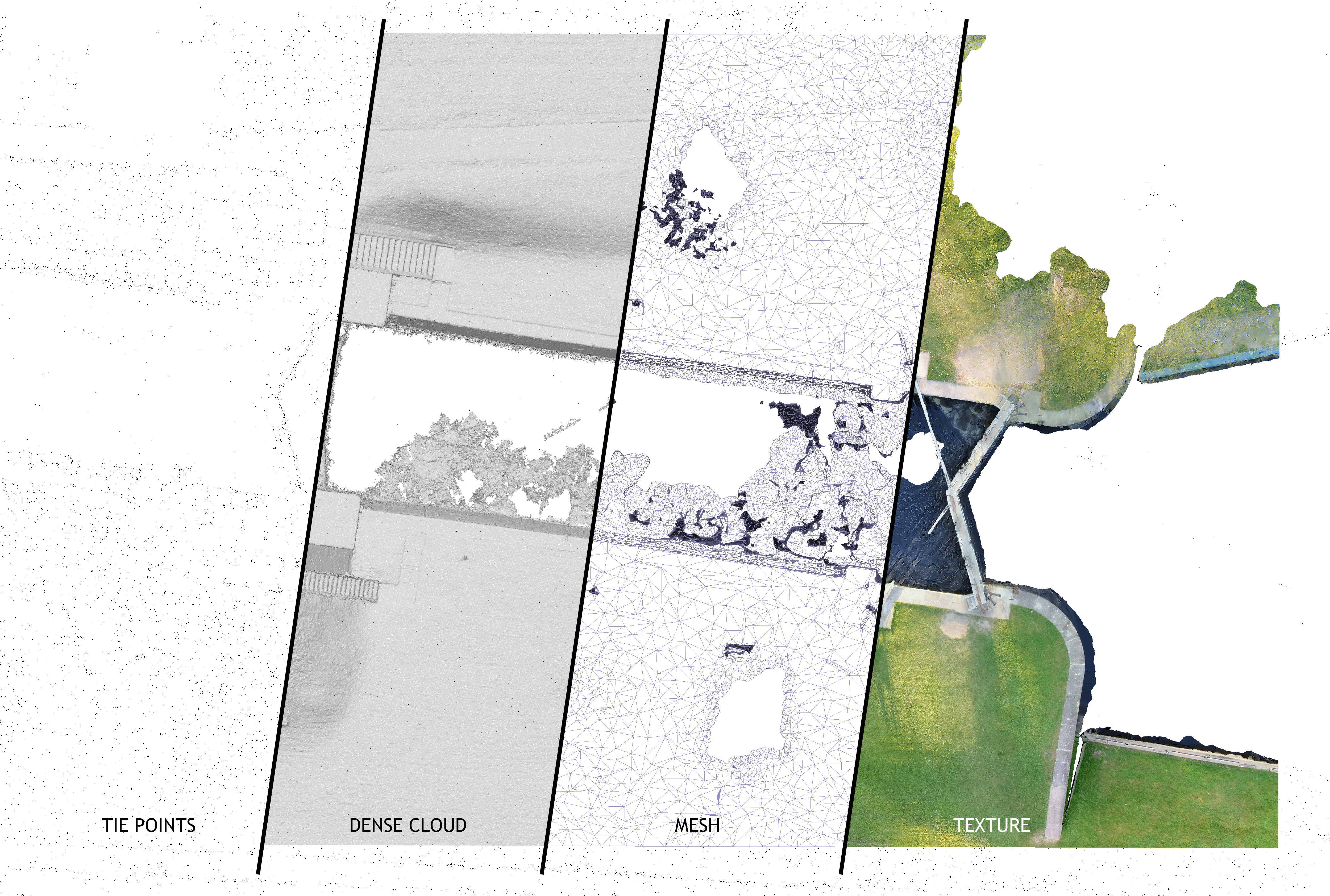
When processed, the software projects the aligned images to create a dense cloud of 3D points that start to resemble the surface of the captured object. This dense point cloud can be triangulated to make a mesh surface with the aligned images projected over the surface. This results in a textured mesh that represents a digital copy of the surface of our object of interest.
CIMS’ documentation of the Rideau Locks Stations illustrates the versatility of photogrammetry. Drones were used to capture site topography, while a hand-held DSLR camera was used to capture the mass masonry lock structures and operational lock mechanisms. The Rideau Locks documentation process contains the large scale documentation of the topography to the small scale documentation of the locks mechanisms. Through the use of different photographic tools, the macro and the micro are captured using the photogrammetric process.
CIMS uses photogrammetry to document small artifacts — such as sculptures in the Centre Block of Canadian Parliament Buildings - to large surfaces — such as the temples in Bagan, Myanmar, and topography such as the Rideau Locks Station captured with drone footage. The data captured creates an excellent record of the existing condition; however, its use does not end there. The photogrammetry data is used to create accurate building information models (BIM) in Autodesk Revit as well as for digitally assisted storytelling projects. For the next few weeks, we will explore how CIMS uses photogrammetry. Stay tuned to learn how it is used to document small artifacts for public dissemination, processed to be included in virtual reality experiences, and how the process differs for underwater documentation.