
Voices of CIMS: Jaron, Jesse, Jerry
This week and next, we showcase work recently produced by three individual researchers of the CIMS team. The researchers were prompted to reflect upon something they had recently or are currently working on. Like mini teasers, these snapshots can also be considered the seeds for future full-length stories on the site for ongoing projects at CIMS throughout the summer.
To start, we present CIMS researcher Jaron Kasiban’s refection on ArcGIS and the ongoing National Capital Model of Ottawa:
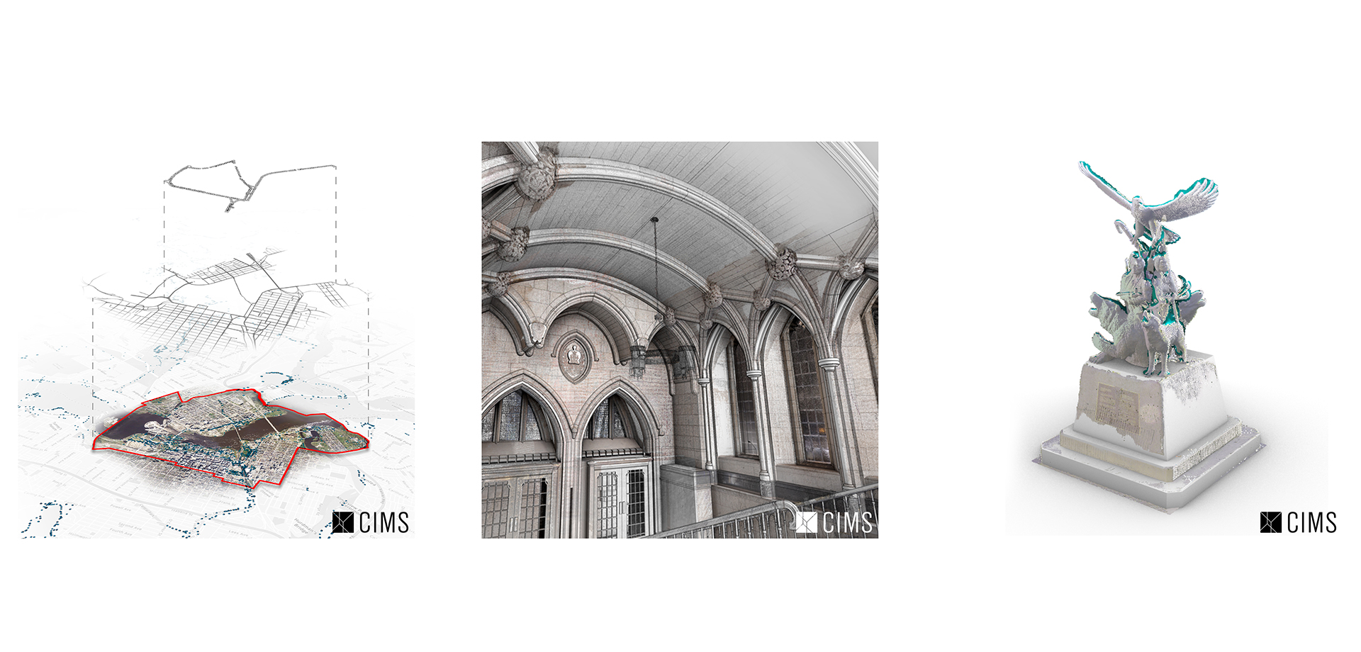
“ArcGIS is the primary tool to gather and visualize collected geospatial data for the National Capital Model of Ottawa. A central database containing asset information provides a foundation that then can be visualized as with assigned 3D models. The GIS data gathered allows for accurate georeferenced placements of assets in the real world. Assigned attributes to these assets are accessible for future potential of a BIM library. GIS data unfortunately has as much potential as the data received, the more data collected and inputted into the model, the more detailed the asset library. An extensive GIS database is necessary for a strong foundation to any form of mapping or modelling at an urban scale.” - Jaron

Working on the Centre Block building information model for several years, CIMS researcher Jesse Rafeiro writes:
“For the Centre Block building information model, a subversion of Revit default tools is often necessary in order to model the complexity of heritage architectural elements. The ceilings are a great example of this scenario since by default Revit ceilings (meant to model more contemporary architecture) can only be flat planes. In order to capture the geometry of the vaulted ceilings and gothic ribs of the Centre Block, custom in-place components are needed to individually model the ribs while the mass-in-place tool (a tool normally used for conceptual modelling) is instead used to define the curvature of the ceiling itself.” - Jesse

Jerry Mangilit introduces and reflects on CloudCompare, one of the most essential tools used at CIMS and in his ongoing work at CIMS:
"CloudCompare is a 3D point cloud editing and processing software that allows us to take a point cloud data of a non-geometric asset such as monuments and statues, and create a mesh from it. The quality of the mesh is defined by the density of the point cloud, so we use Recap alongside CloudCompare to reduce the noise of the point cloud to get us a much cleaner product. This program is important because Ottawa is filled with historical monuments that need to be documented accurately in our work.” - Jerry

Stay tuned in the upcoming weeks to see how these projects evolve.