
Documentation and GIS Platform in Nea Paphos
Nea Paphos is one of three UNESCO Heritage Sites in Cyprus. After forty years of the site’s inscription a comprehensive map of the entire historic site now exists. In 2018 CIMS was contracted by the Getty Conservation Institute (GCI) to map and record the as-found condition of the archaeological site of Paphos, in partnership with the Department of Antiquities of Cyprus (DoA) that will be used for a master conservation management plan.
The main objective of the documentation project was to establish a thorough GIS platform of the UNESCO world heritage site of Paphos, Cyprus. Geographic Information Systems (GIS) have become an essential tool in the research, management, and conservation of archaeological sites. The GIS platform aims to assist in preparing a master management plan for the conservation of the site.
 Map with the contour lines and rainwater drainage lines of the main archeological site of Nea Paphos. Produced from ArcGIS
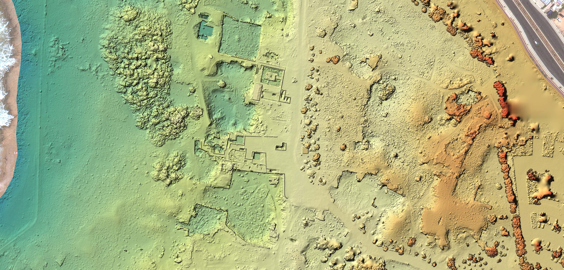
 Digital surface model (DSM) of the main archeological area of Nea Paphos, produced in ArcGIS.
The documentation project was planned in two phases starting in June 2018. Each phase involved recording with 3D laser scanning, terrestrial photogrammetry, and aerial photogrammetry. All the data that was captured was processed and used to develop measured line drawings of archaeological remains, the underground tombs and caves, in addition to producing aerial orthophotos of the entire site and high resolution orthophotos of the exposed floor mosaics. Digital surface and terrain models were generated to reconstruct the topography of the site with a multiscale approach to consider the complexity of the areas. This includes a geographic scale to document the entire city, architectural scales to represent buildings and their features, and one to one scale to capture the details of mosaic tesserae.
 Line drawings overlaid with the aerial orthophoto of an area in Tombs of the Kings, Paphos. The drawings display the different levels including the underground spaces with grey hatch.
All the data developed by the CIMS team, from the measured line drawings to the orthophotos, were geolocated with the Cypriot reference system and integrated in the GIS platform. Existing drawings, maps and photographs that were provided by the DoA were integrated in the platform to provide unified access to a heterogenous data source. All the data sets were uniformed and harmonized in a single working environment where advanced geospatial operations can be done.
An important aspect of this documentation project is capacity building. In addition to documentation and data processing training, a GIS training workshop specific to this project has been conducted in collaboration with the DoA to ensure they have the ability to take advantage of the richness of information encapsulated in the GIS platform.
The documented area is defined in three areas: the main archaeological site, the Fabrika area, and the Tombs of the Kings, which total more than 1.3 million square metres. During the mission over 50,000 pictures were captured in addition to 900 3D scans.
 Luigi Barazzetti and Paraskevi Christodoulou checking line drawings developed by CIMS team and room numbering on site during the validation phase in November 2019.
Over 50 buildings with more than 1330 rooms were documented together with 29 tombs and a series of 14 caves. More than 200 mosaics and pavements were digitally documented and catalogued to generate a comprehensive digital archive in which information about the typology and materials could be embedded.
The collaborative approach developed for the recording of the as-found condition of the Nea Paphos archaeological site has been challenging, yet rewarding. It met several goals in the production of an accurate heritage record of a large, complex site by utilizing sophisticated, yet affordable tools, and has enhanced the capacity of the Department of Antiquities in Cyprus to continue the work through training in the use of GIS and recording techniques.