
National Capital Model in Progress
The National Capital Model is an asset information model (AIM) developed from diverse sets of data provided by the National Capital Commission (NCC). The AIM includes buildings, vegetation, topography and NCC assets, which are divided into existing city wards to facilitate model organization and management. As the model is updated with new data, such as LiDAR, it becomes an increasingly powerful visualization and analysis tool that the NCC can leverage for a range of model uses. For example, the use of the model to dramatically improve the quality and experience of public consultations for signature projects such as the LeBreton Flats redevelopment.
The National Capital Commission (NCC) owns more than 11 percent of the 5,000 square kilometres of Canada’s National Capital Region (NCR). With a mandated focus as a planning authority and land steward, the NCC recognizes that the maintenance and development of these lands does not occur in singularity. Responsible stewardship demands consideration of the interactions of assets with surrounding landscapes owned by private, municipal and provincial parties. To better analyze these interactions, the NCC partnered with CIMS in 2017 to create a digital twin of the core of the NCR. This AIM has been developed to serve as a repeatable sandbox through which stakeholders can make better informed architectural and implementation decisions by virtually challenging new design concepts against a realistic digital environment.
Flexible and portable by design, the underlying technology platforms used to build the NCR model offers a range of opportunity for expansion by integrating the information models of other interested parties, augmenting with metadata, or amalgamating the NCR model with other regional or national models.
One of the main challenges was facilitating model organization, management, and workstation performance at this urban scale. The most effective solution to address the sheer size of the NCR was to adopt a tileable approach based on the division of the model data into legally defined city wards enabling model users to view and download only the required area for their purposes.
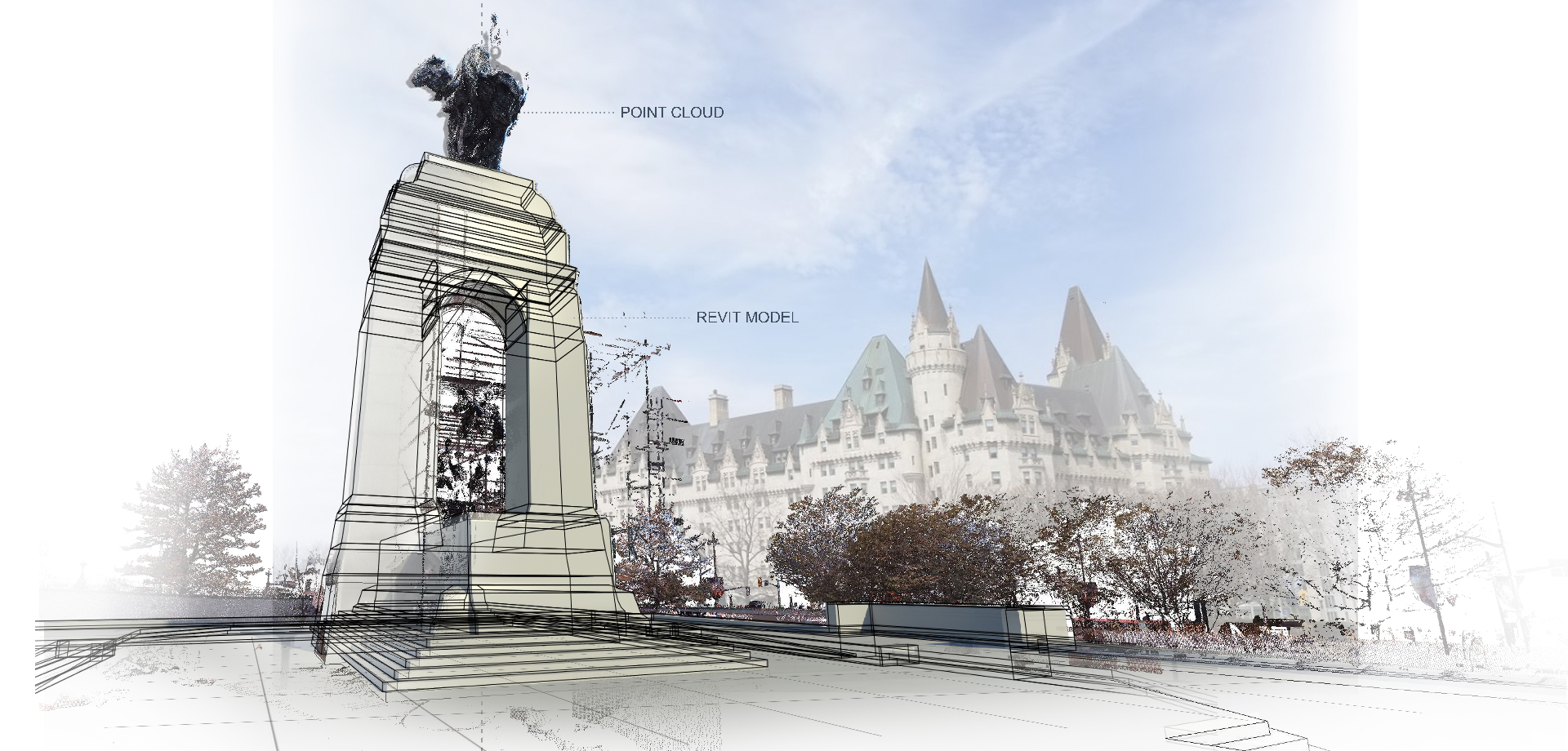
Using existing CAD drawings, point cloud data and LIDAR, CIMS developed an NCC asset library consisting of NCC owned buildings, city furniture (benches, trees, street lamps and bollards), and monuments. Using point cloud data and secondary sources, CIMS created accurate 3D models of each asset. Assets are modelled to two levels of detail (LOD) to optimize performance for specific model uses – LOD1 is optimized for urban scale and LOD2 for highly detailed visualizations. For instance, a visualization of the entire NCR would not require the same high LOD needed to create a visualization of a site-specific intervention.
 Alexandra Bridge Digital Model
 National Aboriginal Veterans Monument in Confederation Park
Once modelled, all of the digital 3D assets were imported into Autodesk Infraworks according to civil point locations and point cloud data. In future iterations, additional metadata, such as project name, group, client, location, BIM and year of construction, will be associated with individual 3D assets.
 Confederation Park Assets in the Infraworks Model
The GIS database and 3D assets are imported into Autodesk Infraworks and are divided into two proposals:
-
A landscape proposal covering the majority of the Ottawa region beyond the NCC core boundary and contains LOD 1 assets for quick urban-scale visualizations;
-
NCC core boundary model containing assets at a higher level of detail (LOD2) for model uses that require a highly detailed model.
This Asset Information Model (AIM) allows the NCC to understand and develop their current properties and assets systematically. Furthermore, they will be able to envision future design proposals using the model as an analytical tool and to create thorough tests on urban spatial attributes, landscape design and urban navigation. Considering the bigger picture, the NCC can keep the capital city a thriving and interconnected community.