
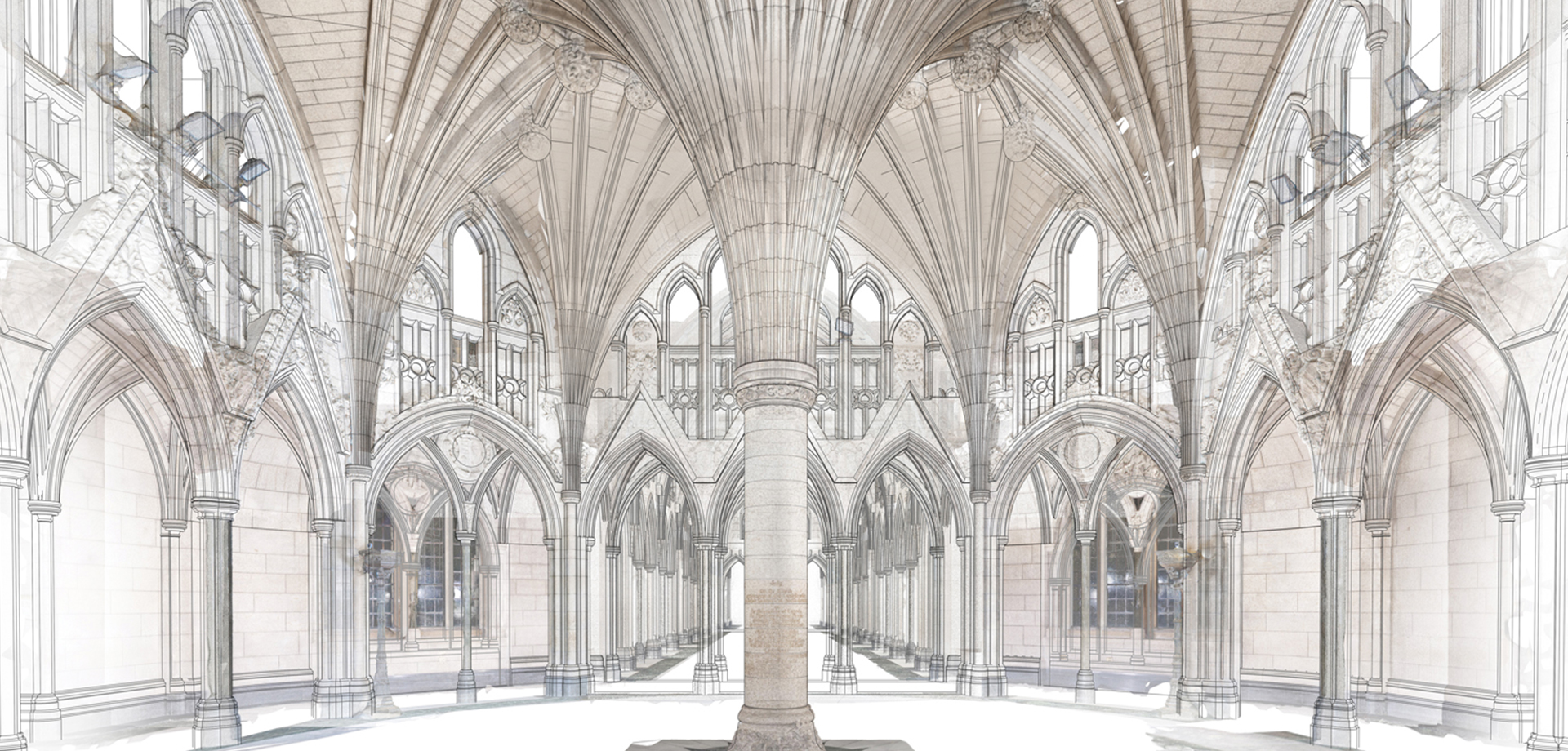
HBIM to VR
CIMS has recently been developing techniques for adapting HBIM for VR. This is a complicated process: HBIM elements are often highly detailed and do not translate well to VR considering limitations of overall polygon count. Basically the more fine detail we have, the less likely it will display in VR. Responding to this challenge, we developed a classification system where we can assign priority to how simplified certain BIM elements must be, based on the elements architectural and visual significance. Doing so allowed us to balance the competing demands of detailed geometry and a visually satisfying result.
Our process for creating high-fidelity VR experiences of cultural heritage spaces involves combining together different kinds of digital media derived from survey and recording methods. This scene of the Senate Chamber combines a heritage building information model (HBIM), photogrammetry, and HDR photography. These different digital assets have different advantages and disadvantages when inserted into a VR scene - photogrammetrically generated models can demonstrate highly accurate 3D geometry, but at the cost of many polygons; HBIM allows for the possibility of optimized 3D elements, but requires manual modelling; and photography allows for highly detailed textures, but a lack of surface data. We also developed methods for combining different assets for greater optimization. A significant question becomes: which assets are necessary to show as 3D models, and what information can be collapsed to 2D information? For example, taking the detailed texture of a photogrammetric model and projecting it onto a simplified HBIM element. Often surface details, which really give the elements their impressive character, can be simplified to 2D images, normal maps, which give the illusion of shadow and depth. Can you spot where the various asset types were used in the scene below?

In our recent TAD article we discuss our approach of simplifying various digital heritage assets for use in VR, but we made a curious observation about the difference between traditional hand-draughting, and 3D modelling. As we saw with the students working on this project, it becomes very difficult for the modeller to decide what is an appropriate level of detail in modelling complex geometries. The pointcloud data we use as a modelling reference in Revit often shows detail down to the nearest millimeter, a degree of detail which was simply unachievable through previous manual surveying methods. But modelling to this level becomes a fool’s errand - one quickly encounters the various problems of having ‘too much information'. However the complexities of architectural documentation have always had to deal with ‘too much information’ in various ways, and one can learn from traditional methods of reducing and simplifying information. Simply stated: when drawing by hand one physically cannot draw detail that is too small and irrelevant, by nature of the size of a pencil.
We asked our modellers to model it the way you would draw it.
 (image source: Pearson & Marchand. “Senate Chamber Cross Sections Back and Front North and South Arcading,” June 27, 1917. National Archives-1999. Library and Archives Canada.)
Check out our TAD article for the full story, Defining Geometry Levels for Optimizing BIM for VR: Insights from Traditional Architectural Media, https://doi.org/10.1080/24751448.2019.1640541