
Understanding the CIMS Streams of Inquiry: Digitization
Of the many documentation technologies available to the 21st c. architect, modern tools that can digitally capture a building and its site continue to evolve and provide new possibilities for visualization, modeling and analysis.
Digitization is the process of documenting a physical object with a scanning device so that its digital copy can be utilized in a given software for any specified application. Digitization simply put, is taking measurements of an object and recording them, just like we would with a tape measure.
Many different tools can be considered digitization devices, a cellphone camera is one for example, but here we will briefly discuss the digitization method we use at CIMS including photogrammetry, 360 photography, aerial LIDAR. Since our primary method of digitization is terrestrial laser scanning, we will dive into that subject a little deeper.
Types of Digitization used at CIMS
Photogrammetry
Photogrammetry is the art, science, and technique of obtaining reliable metric information about physical objects and the environment, rough recording, measuring and interpreting photographic images, or patterns of electromagnetic radiation and other phenomena (ISPRS, 1980). Modern close-range photogrammetry (often called Structure-from-Motion (SfM) photogrammetry) provides a relatively inexpensive and fast method for obtaining geometric measurements from a series of photographs. Photogrammetry uses overlapping images to calibrate the camera and calculate the locations of those images relative to an object. From there, photogrammetric data can be used to create a point cloud, a mesh, or an orthographic photo (orthophoto).
Another form of photogrammetry is aerial photogrammetry which uses a camera attached to an aerial vehicle or system, such as a drone, to capture overlapping photogrammetric images from an aerial perspective. This method is often used for the documentation of topographic areas and roofs of buildings. This resulting data, like close-range photogrammetry, can be used to generate point clouds, meshes, and orthophotos.
 A photogrammetric model of a locks mechanism.
Aerial LIDAR
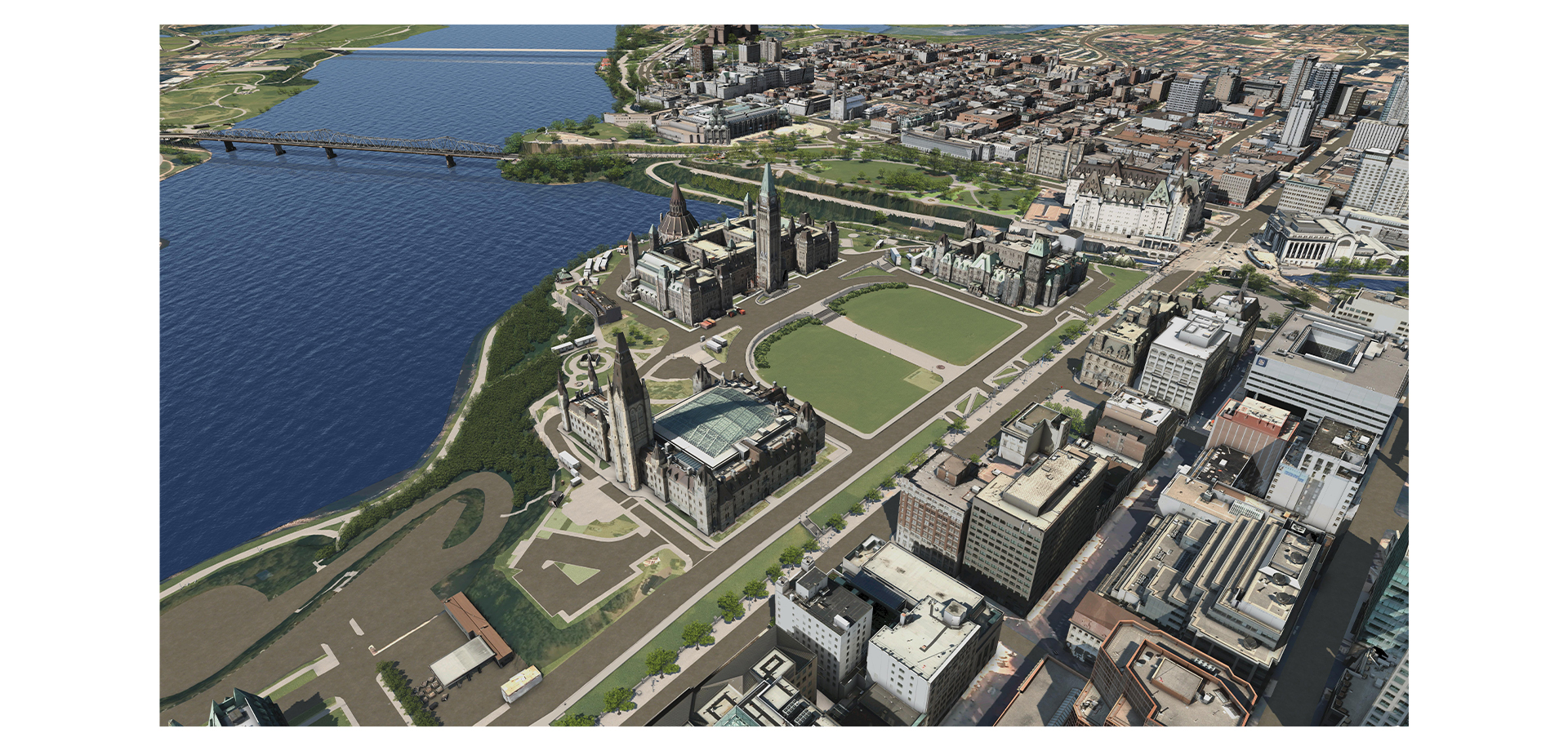
Aerial Lidar uses laser scanning technology that is attached to an aerial vehicle. It is used to record large geographic areas — including urban and rural topography and the roofs of buildings not accessible for terrestrial laser scanning. At CIMS we typically use LIDAR data to develop large urban scale models.
 *A model of Downtown Ottawa created using aerial scanning technology. *
360 Photography
360-degree photography captures a fully spherical view of a single point in space. A 360-degree photo is typically taken by a group of cameras or a single camera with multiple lenses. The images from each lens overlap each other and are stitched together to create a panoramic (360-degree) image.
 360 image of the Senate Chamber in parliament.
Terrestrial Laser Scanning (TLS)
TLS is the most common type of digitization method we use at CIMS. Through laser scanning, we record measurements using digital memory to speed up the process, increase the amount of measurements, and add other information like color. The process may seem novel, but the core procedure of documenting objects by measuring from a known point has a very long history.
An early example from said history is provided by the 15th c. Italian Architect and Renaissance Man, Leon Battista Alberti. Alberti invented a prototype "laser scanner" in order to measure the walls of Rome. The idea is simple, nail a post into the ground at the center of the area you would like to measure, tie a rope around the post, then pull the rope out to the wall and record the measured distance and angle. Once you’ve taken the measurement, it can be recorded on a disc with a scaled ruler.
 *(Aureli 2011), https://www.architectural-review.com/essays/books/reading-the-digital-revolution. *
Similar to Alberti’s scaled drawing of Rome, the output from a laser scanner is a list of coordinates; but instead of originating from a post, the measurements are recorded relative to the center of the laser scanner. In addition to the basic x, y coordinate data, the laser scanner adds richness by capturing measurements in 3 dimensions, as well as color, and in some cases global coordinates.
Laser scanners come in many different forms and can be used for many different applications. The density and accuracy of the data define the different forms of scanners. For large scale measurements, like forests or cities, Lidar scanners like RIEGL scanners can be attached to a plane and flown over an area
 (“RIEGL - Produktdetail” n.d.), https://rapidlasso.com/category/riegl/page/2/
For documentation at the scale of buildings, ground based laser scanners like the P40 are appropriate.
 CIMS scanning at parliament hill with the Leica P40
For scanning objects at the scale of a human being and smaller, hand scanners are very useful because they can capture the highest density of points of the three
 (“Best Handheld 3D Scanners - Aniwaa’s Top 5 for 2021” n.d.), https://www.aniwaa.com/buyers-guide/3d-scanners/best-handheld-and-portable-3d-scanner/
Ground based scanners and hand scanners are the two types of scanners we use most commonly at CIMS.
At CIMS, we use digitization to capture physical objects for a wide range of projects. We used a Leica ground based scanner to build a data set for many of our earliest projects including models of the Rideau Locks and Batawa. We’ve continued to use ground based scanning as the data source for many of our projects including the Parliament Hill Building Information Models. At a small scale we’ve employed the hand scanner to generate digital surfaces for objects like the leaf carvings used in our digitally assisted fabrications research for the Senate, and at the largest scale we’ve employed aerial Lidar scans to map the city of Ottawa for the National Capital Model.
Digitization, and more specifically laser scanning, has played an important role in developing research at CIMS. When setting out, one of the most important features of an architectural research project is to ensure that we are working with high quality data. If working with existing buildings, starting with accurate laser scans that we captured enables us to guarantee the accuracy of our research and continue to develop the data set over time.
Bibliography
Aureli, Pier Vittorio. 2011. “Reading the Digital Revolution.” Architectural Review (blog). September 21, 2011. https://www.architectural-review.com/essays/books/reading-the-digital-revolution.
“Best Handheld 3D Scanners - Aniwaa’s Top 5 for 2021.” n.d. Aniwaa. Accessed May 14, 2021. https://www.aniwaa.com/buyers-guide/3d-scanners/best-handheld-and-portable-3d-scanner/.
“RIEGL - Produktdetail.” n.d. Accessed May 14, 2021. http://www.riegl.com/nc/products/airborne-scanning/produktdetail/product/scanner/72/.