
CIMS goes to Colombia
Through the leadership of Dr. Mario Santana, Carleton Immersive Media Studio (CIMS) has travelled the world documenting historical sites and training others on the use of different documentation techniques. Photogrammetry, surveying, terrestrial laser scanning, and reflectance transformation imaging (RTI) are taught in workshops and documentation projects to the local professionals. In April and May, CIMS visited Colombia, the land of El Dorado ¬– the legendary lost city of gold. While keeping an eye out for the mythical city that’s discovery would fund future projects, CIMS taught a workshop about the digital documentation of the built heritage and to document two World Heritage Sites: the National Archaeological Park of Tierradentro and San Agustín Archaeological Park.
The workshop, led by Mario Santana Quintero with the assistance of Miquel Reina Ortiz, was attended by professionals of the Colombian Institute of Anthropology and History (ICANH) and teachers and students of the Program for the Conservation and Restoration of Movable Heritage from the University of Externado of Colombia. The main goal of the collaboration was to teach different digital recording techniques applied explicitly to wall paintings and carved elements and document both sites.
After a two-day theory workshop in Bogotá, Colombia, the group travelled to the municipality of Inzá at the southwest of Colombia in the Andean’s central cordillera, to document the National Archaeological Park of Tierradentro – known for its monumental shaft and chamber tombs —the hypogea. The hypogea are underground burial spaces that served the elite groups from 600 to 900 AD. Excavated usually five to eight metres below the surface, they split into a network of various chambers.
This project’s goal was to teach different recording techniques through the documentation of four identified spaces of the world heritage site. Participants of the workshop learned how to document the hypogea’s decorated surfaces – painted and carved with geometric, anthropomorphic, and zoomorphic patterns. Participants practiced surveying with a total station, laser scanning, digital photography, condition assessment photography, terrestrial and aerial photogrammetry, and RTI.
One of the significant challenges the workshop encountered was with the interior photogrammetric work. The reduced dimensions of the interior space, poor lighting, and the complex geometry of the decorated surfaces required the acquisition of a high number of photographs. To ensure consistent lighting, participants had to move the flashes and umbrellas around the elliptical space continuously. The participants nicknamed the required movement ‘el baile de la fotogrametría’ or ‘the photogrammetric dance’ due to its complicated series of steps and hand movements.
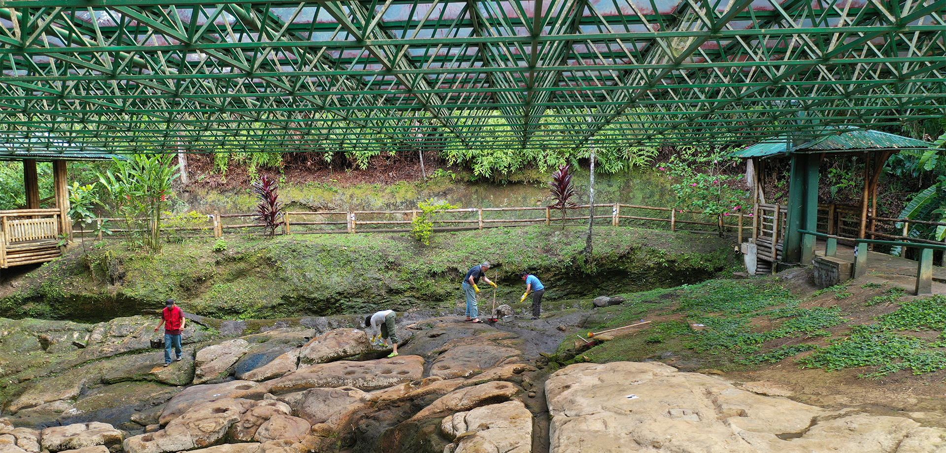
After an intensive four-day workshop capturing all the data required, the workshop group drove south to the archaeological site of San Agustín to document the ceremonial fountain of Lavapatas. This natural area is placed in the Colombian Massif on the southwest of the Andes in the department of Huila, featuring the largest complex of pre-Columbian megalithic structures in the region. The objective of this second part was to document the fountain of Lavapatas - a natural site used for ancient religious ceremonies and baths. A series of pools and channels are carved into the stone to channel the water with human and animals motives. During a day and a half —and despite a momentary torrential downpour— the group surveyed with a total station, laser scanned, and conducted terrestrial and aerial photogrammetry and Reflectance Transformation Imaging (RTI). With the documentation, an accurate 3D digital reconstruction of the area will be constructed to monitor its level of degradation.
With the natural spring’s documentation, we finished our trip to Colombia. We never found El Dorado; in fact, we forgot about it. Instead, we discovered two strikingly beautiful national parks, while working alongside our new Colombian colleagues.