
Building the Viewshed Analysis Application
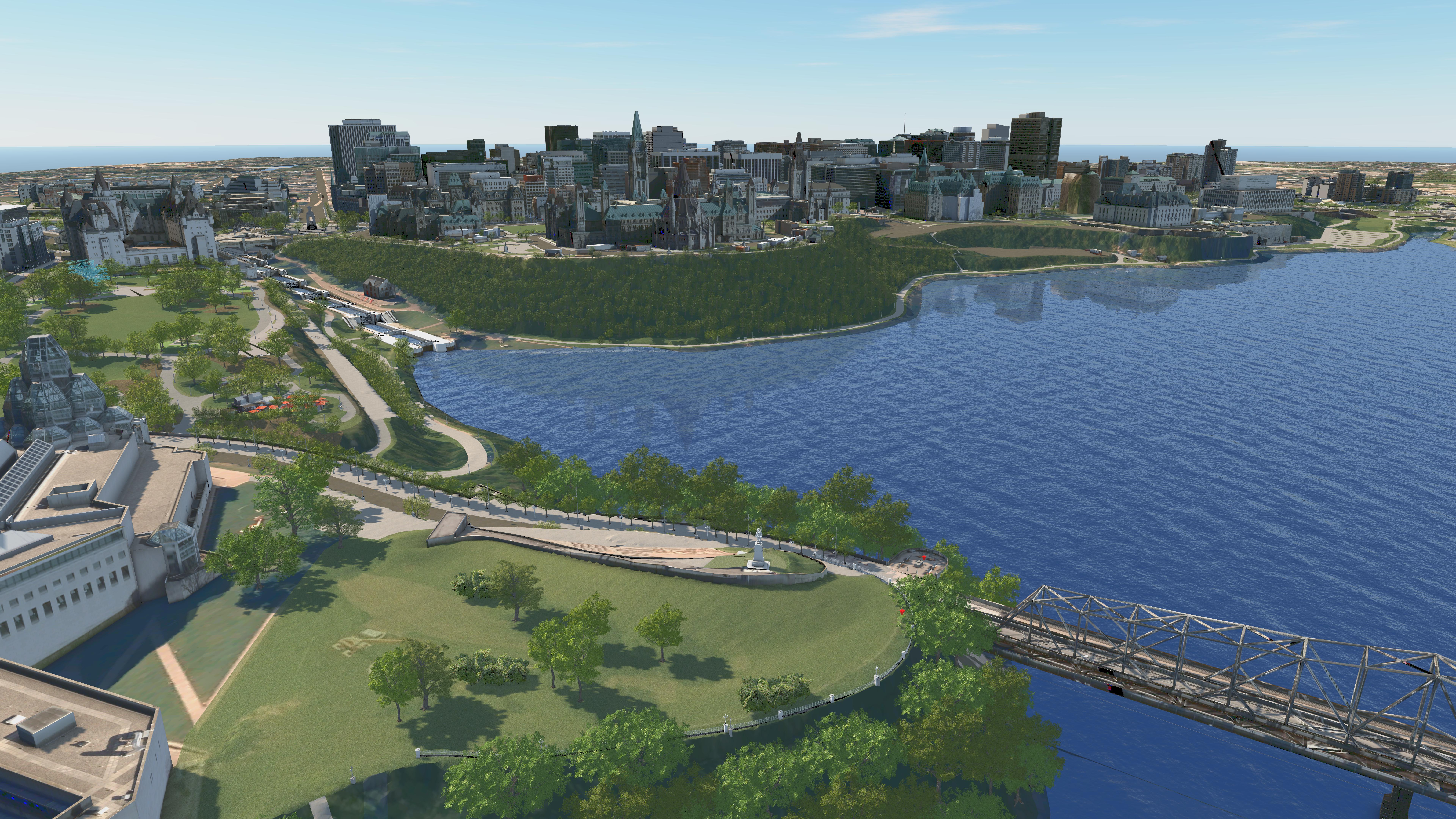
This summer CIMS developed a powerful visualization and analysis tool for the National Capital Commission (NCC) – the National Capital Model (NCM). The NCM is an asset information model (AIM) consisting of large, complex data sets including geolocated textured buildings, vegetation, topography, and NCC and city assets.
A goal of the project was to ensure the datasets could be deployed in a range of software enabling a wide range of uses across disciplines and departments. Using the AIM's existing datasets, CIMS created an Epic Games’ Unreal Engine application to visualize and analyze the protected Viewsheds in the Nation’s Capital.
Viewsheds are protected views composed of a viewpoint, a background and a foreground. The viewpoint is the point from which a viewer observes the subject of a scene. The background is the area visible behind the subject of a scene and the foreground is the area between the viewer and the subject. This allows for the control of foreground areas to avoid blocking of the view as well as the control of background areas to avoid obscuring or competing with the silhouette of the Capital’s skyline.
One of the NCC’s mandates is to protect the visual integrity and symbolic primacy of the Parliament Hill National Historic Site and other national symbols. With pressure for cities to grow taller and expand wider, it is important for cities to maintain the visual integrity of their skylines - something especially significant for Capital cities.
 The viewpoint analysis application's start page
The Viewshed Analysis Application consists of the 21 viewsheds located in Ottawa and Gatineau. The main function of the app is to analyze the potential impact of proposed developments within the viewsheds from a first-person perspective. With imported assets that range from benches, street lamps, planters and more, the user can access the Capital Region’s digital model within a portable application. By observing different viewsheds, one is able to consider spatial attributes, landscape design and achieve an overall idea of how future developments will coexist within the city’s skyline and core neighbourhoods.
To analyze the existing and proposed conditions of the 21 viewsheds, several features were implemented in the application.
Teleporting to each viewshed: Users can transport to a first-person view of all 21 viewpoint locations by clicking on the viewshed list. Once in a specific viewpoint, the user can look around 360 degrees and is able to assess the viewsheds’ surrounding environment.
 The NCC viewpoint application's list feature
Importing proposed models:
One of they key features is being able to import georeferenced models in order to see its effect on the viewsheds. When a building proposal exceeds the maximum height, the application sends out a warning, which allows users to understand the proposal's physical presence within the Nation’s Capital.
Visualization Toggles:
The user has access to toggleable layers of data such as turning on and off vegetation, point cloud data and maximum building height envelopes. This allows them to examine a range of important elements within a scene.
High Resolution Screen Capture:
To share and compare user’s analyses, high-resolution screen captures of views can be taken to provide documentation and support ideas.
One of the main challenges was compiling all of the datasets in Unreal Engine since this software does not use real world coordinates. Additionally, certain assets also needed to be optimized by reducing their polycount to ensure a smooth-running application.
 Confederation Boulevard in Unreal game engine
The Viewshed Analysis Application allows the NCC to understand their current and proposed properties and assets systematically. With this application, the user has access to the National Capital Model as an analytical tool through the 21 viewshed locations, allowing them to test future design proposals and developments.
 Ottawa's National War Memorial
Although the current focus of the application is the analysis of the existing viewsheds, the existing structure of the application allows for a diverse range of uses and possibilities.
The application could be a sandbox that allows the NCC and other stakeholders to make better informed architectural and landscape decisions by importing and comparing new design concepts to a digital environment. Visualizing zoning, enhancing the quality and experience of public consultations and viewing proposals in a virtual reality headset are just a few of the many possibilities.